forums
new posts
donate
UER Store
events
location db
db map
search
members
faq
terms of service
privacy policy
register
login


UER Forum > Private Boards Index > Peterborough (Ontario) Region UE > Aerial view (Viewed 3338 times)
otonabee 


Location: Peterborough/Bowmanville, Ontario,Canada/ Crypto urbano
Gender: Male
Total Likes: 2 likes


I'm not from here

 |  |  | otonabee youtube
Aerial view
< on 9/14/2007 7:36 PM >
Reply with Quote
Posted on Forum: UER Forum
At this time Google earth does not provide a high resolution view of our area but there are two other sources you may reference

City of Peterborough interactive map:This map provided on the city of Peterborough website provides an aerial view in black and white with an image that is dated 1996
88938.jpg (100 kb, 640x460)
click to view

Image of GE plant from city website

County Peterborough GIS map: Another view of Peterborough this time found on the County of Peterborough website. It will provide you with a colour image of the county and the city. The images are dated 2002. I prefer this site over the city site because of the images being less dated and in colour
88939.jpg (84 kb, 640x521)
click to view

This is the county website image of GE. This image is much more blurry than the actual website image (I messed up somewhere along the way)


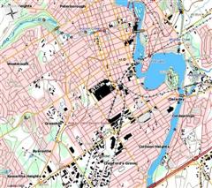
Toporama website: Another source of Topo imaging is this site. Smaller buildings are not indicated in large populated areas but are indicated in the rural areas and there is no aerial imaging with this site


There is also a map making feature on the Government of Ontario website
in the Land information Ontario section
Ontario government topo map maker


Calvin: It's a magical world, Hobbes, Ol' Buddy . . . let's go exploring!
otonabee 


Location: Peterborough/Bowmanville, Ontario,Canada/ Crypto urbano
Gender: Male
Total Likes: 2 likes


I'm not from here

 |  |  | otonabee youtube
Re: Aerial view
< Reply # 1 on 4/1/2008 11:44 PM >
Reply with Quote
Posted on Forum: UER Forum
I noticed that the city of Peterborough and some of Peterborough county are now high resolution on Google earth. It is a winter view and the quality does not match up to the view i enjoy from google earth of my new home town /area (Bowmanville/Durham region) but at least you can make out houses and other objects now


Calvin: It's a magical world, Hobbes, Ol' Buddy . . . let's go exploring!
fedge 


Location: Gaud Corners, Ontario, Canada
Gender: Male
Total Likes: 11 likes


you blight up my life™®

 |  |  | Fedge Explorations
Re: Aerial view
< Reply # 2 on 4/2/2008 3:06 AM >
Reply with Quote
Posted on Forum: UER Forum
Odd they'd employ a winter view. The Peterborough and area on Google Maps still sucks, even zooming in on the city itself.


18-odd Years Of UER-ing!
UER Forum > Private Boards Index > Peterborough (Ontario) Region UE > Aerial view (Viewed 3338 times)


Add a poll to this thread


This thread is in a public category, and can't be made private.


All content and images copyright © 2002-2024 UER.CA and respective creators. Graphical Design by Crossfire.
To contact webmaster, or click to email with problems or other questions about this site: UER CONTACT
View Terms of Service | View Privacy Policy | Server colocation provided by Beanfield
This page was generated for you in 97 milliseconds. Since June 23, 2002, a total of 739258940 pages have been generated.