|
|
|
UER Store
|
|
 order your copy of Access All Areas today!
|
|
|
 |
|
|
|
|
Location DB >
United States >
Pennsylvania >
Centralia >
Centralia
|
|
Log in to activate viewing options
|
|
|
created by PonyGrl420
on 11/17/2003 2:16 AM
last modified by Gecco
on 1/2/2023 8:31 AM
|
|
 |
Publically Viewable |
|
This location has been labeled by its creator as Public, and therefore can be viewed by anyone.
|
|
|
|
|
|
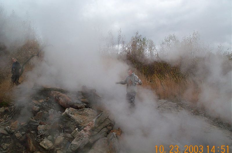
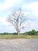
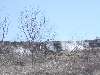
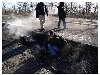
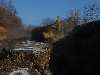
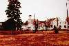
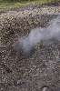
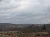
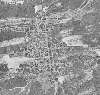
Small coal town that sits atop a burning coal seam. Not much is left, aside from the few occupied homes and a fire station. On one of the back roads there is a silo and large open tank filled with green water.
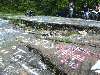
4.19.2021 - As of late 2020, one of the key draws to this site, "graffiti highway" was covered in hundred of piles of dirt. You can still walk back there, but there really isn't anything to see anymore.
|
|
|
Type: Outdoors
Status: Active
Accessibility: Easy
Recommendation: check it out if you're nearby
|
|
|
Address
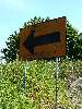
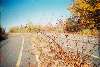
Route 61
Centralia, Pennsylvania
United States
Owner: State of Pennsylvania / Blaschak Coal Corp
See a map of this location
|
|
|
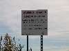
unsafe flooring
air quality
sink holes, mine fire
|
|
|
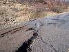
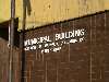
in 1992 the government claimed eminent domain however seven people still live here. Smoke, coming out of the ground, a large crack in the closed section of Rt. 61, Many sinkholes and unsafe ground. Old streets, a Municipal building which houses the fire company that is manned by volunteers from Aristes and a few houses.
The remaining church in the borough holds weekly Saturday night services, and the borough's four cemeteries are still well-maintained.
|
|
|
|
|
|
|
|
good hiking shoes, camera
|
|
|
It was known as Centreville until 1865, when the name was changed to Centralia and the post office was established.
The anthracite coal industry was the principal employer in the community. Coal mining continued in Centralia until the 1960s, when most of the companies went out of business. Bootleg mining continued until 1982.
Strip and open-pit mining is still active in the area, and there is an underground mine employing about 40 employees three miles to the west.
The borough once had seven churches, five hotels, twenty-seven saloons, two theatres, a bank, post office, and fourteen general and grocery stores along with its schools.
Its population was at one time over 2,000 residents. Now there are only 12.
The fire was started in a garbage dump over an open coal seam in May of 1962. It was common to burn the garbage on a weekly basis in the landfill, located in an abandoned mine pit in the southeast portion of Centralia.
In July of 1962, the Department of Environmental Resources started to monitor the fire. Boreholes were drilled to check to extent and the temperature of the fire. Gas monitors were also installed in most homes in the area above the hottest fire. Attempts to put the fire out were unsuccessful, and it continued to burn throughout the 1960s and 1970s.
In 1984, Congress allocated more than $42 million for relocation efforts. Most of the residents accepted buyout offers and moved to the nearby communities of Mount Carmel and Ashland.
In 1992, Pennsylvania claimed eminent domain on all properties in the borough, condemning all the buildings within the borough. Current residents are considered squatters by the government.
The residents to save the Borough of Centralia was formed to try to save the town. It garnered a lot of attention to state and local officials, but none the less, they encouraged them to move. As people left, their homes were razed.
|
|
|
|
|
There is talk that many will turn up in 2016 to open a time capsule buried in 1966 next to the veterans’ memorial.
(Time Capsule opened two years early, in 2014, due to an attempted theft.) Pennsylvania's current plans for Centralia are to allow it to return to wilderness.
|
|
|
|
|
|
|
|
|
|
|
|
|
|
|
|
|
|
|
|
|
|
|
|
|
|
|
|
|
|
|
|
|
|
|
|
|
|
 6/2013
Thu, Feb 16th, 2023
posted by KD20
9 pictures
|
|
|
|
|
|
|
|
|
The moderator rating is a neutral rating of the content quality, photography, and coolness of this location.
| Category |
Rating |
| Photography |
10 / 10 |
| Coolness |
10 / 10 |
| Content Quality |
10 / 10 |
|
|
 This location's validation is current. It was last validated by
Emperor Wang on 2/17/2023 2:39 AM.
This location's validation is current. It was last validated by
Emperor Wang on 2/17/2023 2:39 AM.
|
|
|
on Feb 17 23 at 2:39, Emperor Wang validated this location
on Feb 16 23 at 20:39, KD20 added some pictures to a gallery
on Feb 16 23 at 20:36, KD20 created a new gallery
on Jan 2 23 at 14:44, Steed validated this location
on Jan 2 23 at 8:31, Gecco changed the following: Hazards
on Jan 2 23 at 8:30, Gecco changed the following: Description, Web Links
on Apr 19 21 at 22:09, Emperor Wang validated this location
on Apr 19 21 at 17:42, fr00tCake changed the following: Description
on May 29 19 at 1:58, Emperor Wang validated this location
on May 29 19 at 1:39, Gecco changed the following: Future Plans
|
|
|
|
|
|
|
Is this location inappropriate / broken / missing key info?
If it's something you can fix, please scroll up and click the EDIT button.
If this location was only posted a few days ago, give the creator time to work on it.
Please try sending a message directly to the creator of the location. You'll find that info at the top of this page.
Otherwise, ONLY if you've already tried to contact the original creator,: Click here to notify an administrator.
|
|
|
|
All content and images copyright © 2002-2024 UER.CA and respective creators. Graphical Design by Crossfire.
To contact webmaster, or click to email with problems or other questions about this site:
UER CONTACT
View Terms of Service |
View Privacy Policy |
Server colocation provided by Beanfield
This page was generated for you in 125 milliseconds. Since June 23, 2002, a total of 739354449 pages have been generated.
|
|