| Posted by nostra-YOUPPI! |
12/5/2005 4:09 PM | remove |
for years this canal saw only upstream traffic, downstream traffic ran the river here, during seaway construction it saw 2 way traffic because of the dam being built, the entire business district of iroquois is now under water
|
 |
| Posted by Emperor Wang |
12/6/2005 1:08 AM | remove |
I think you're confusing your towns, nostra. It was Morrisburg (on the Rapid Plat Canal) that that lost one or two of its waterfront streets and got a new business district on highway 2. Iroquois was completely relocated. The only original buildings I found there were the Carmen House museum, and something that looked like a lighthouse keeper's place near the new locks on Iroquiois Island. Both of which were closed when I visited :-(
|
|
| Posted by nostra-YOUPPI! |
12/6/2005 4:28 AM | remove |
yeah the entire town of iroquois was flooded you are right, mr van der ahh worded it that the business district was under 20 feet of water. ill have to dig out my old pics of this!
|
|
| Posted by Emperor Wang |
12/6/2005 4:57 AM | remove |
I'd be very curious to see those pics, nostra. From the pre and post-Seaway pics and maps I've seen of the area around Iroquois, the shoreline didn't change all that much even though the entire town was moved uphill. I've got a sneaking suspicion that the excavations from the immediate area were dumped right where the old town used to be, but that's just my guess.
What I would give to spend a couple of weeks poking around Ontario Hydro's archives...
|
|
| Posted by nostra-YOUPPI! |
12/6/2005 1:11 PM | remove |
the pics i found were before any construction and after the dam was built prior to flooding, the old town site judging by your maps looks pretty intact, there is a cool pic of crysler memorial park when it was barren the trees that have since grown make it look very nice. the book also has some nice engineering maps listing the dykes and the like
|
|
| Posted by LostintheWoods |
5/11/2006 12:42 AM | remove |
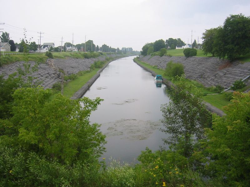
BTW: The banks are lined with rock to prevent them from eroding, which would choke the canal with silt, and make dredging necessary.
|
|
| Posted by Emperor Wang |
5/11/2006 1:31 AM | remove |
Yeah, I didn't stop to think that rainwater would naturally wind its way down into this big cut in the earth. Thanks.
|

 order your copy of Access All Areas today!