forums
new posts
donate
UER Store
events
location db
db map
search
members
faq
terms of service
privacy policy
register
login


Location DB > Canada > Ontario > Aurora > Leslie St. Farm > neX's Sep 16 2006 visit > LS-31.jpg

19 / 25   LS-31.jpg

Description
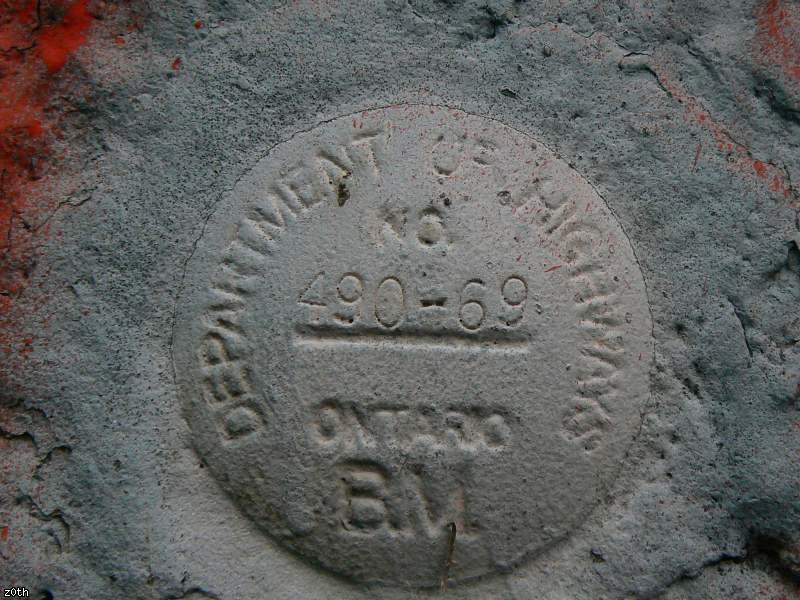
"Department of Highways - No 490-69 - Ontario - BM"

im not quite sure what this is. possibly a survey mark of some kind. found beside the door in the next shot.
Controls

Return to Main Location Page

Return to Gallery Overview

Edit this Gallery

Edit this Picture

Un-Subscribe this Picture
Comments
Posted by Emperor Wang 9/17/2006 5:49 PM | remove
  BM = benchmark. Yeah, it's a reference point for the surveyors.
Posted by z0th 9/20/2006 2:13 AM | remove
  yep. i tapped a surveryor i know for info.

"the 490-69 represents the benchmark # that would be published in the Dept. of Hwy's list of benchmarks. You could look it up to find out what elevation it represented !! These types of things are scattered throughout the countryside and in the city for surveyors and engineers to use."
If you'd like to add a comment, please login or register.


All content and images copyright © 2002-2024 UER.CA and respective creators. Graphical Design by Crossfire.
To contact webmaster, or click to email with problems or other questions about this site: UER CONTACT
View Terms of Service | View Privacy Policy | Server colocation provided by Beanfield
This page was generated for you in 406 milliseconds. Since June 23, 2002, a total of 739216328 pages have been generated.