|
|
|
UER Store
|
|
 order your copy of Access All Areas today!
|
|
|
 oysterhead00
 
Location: Boonies, NC
Gender: Male
Total Likes: 225 likes

 | |  | |  | Re: Using Google Earth in a rural area...
< Reply # 27 on 7/27/2016 11:22 PM >
| Reply with Quote
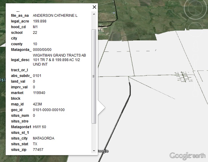
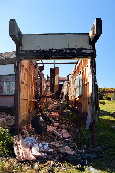
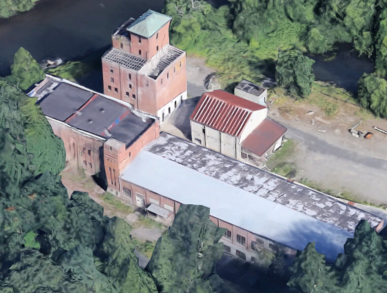
| | | I'm still new here so this might be useless advice, but I'll throw it out there... I'm a fan of Google Maps and have used it a lot, but lately have been using Bing Maps, particularly the Birds Eye View, as well. The satellite views are different so you get an idea if the site is active or not, and then the factories that have old looking roofs yet are completely active and maintained are always tricky. The Birds Eye View adds a LOT to that equation as you can see it's well kept other than it's roof. When exploring online now, I start in Google Maps as that's what I'm used to, right click on the exact area to get the coordinates, plug them into Bing Maps, and get a "second opinion". For what it's worth, the original post looked like a scrapper's/hoarder's compound that would likely introduce themselves to me with a shotgun and I wouldn't even consider going there  For illustration purposes, here are a bunch of pictures for a famous location that has been in a state of demo/repurposing for a while. There are Google Sat and Street views, as well as Bing Sat, Street, and Bird views. Sorry for the crappy cropping and stuff, but trying not to break too many rules about locations...but the "step ladder" buildings in the very front are gone, and the big white building by them is LONG GONE (aka - I never saw it standing). These are current screen caps taken right now that show how active a site it is, and if you just went to one and saw the "step buildings" and made a big trip to see them, you'd be really upset. Trust me, been there and done that. The more sources you can use, the better off you are. 1. Everything is there 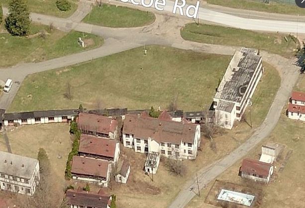 2. Seperate white building is gone, stair buildings still there 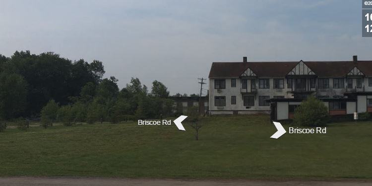 3. Everything is there 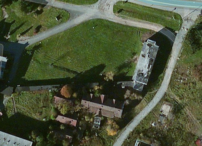 4. White building and stair building are both completely gone 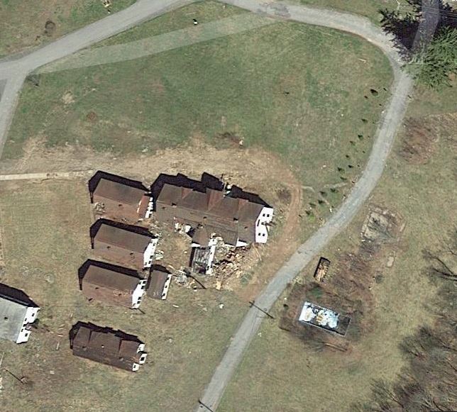 5. Every thing is there 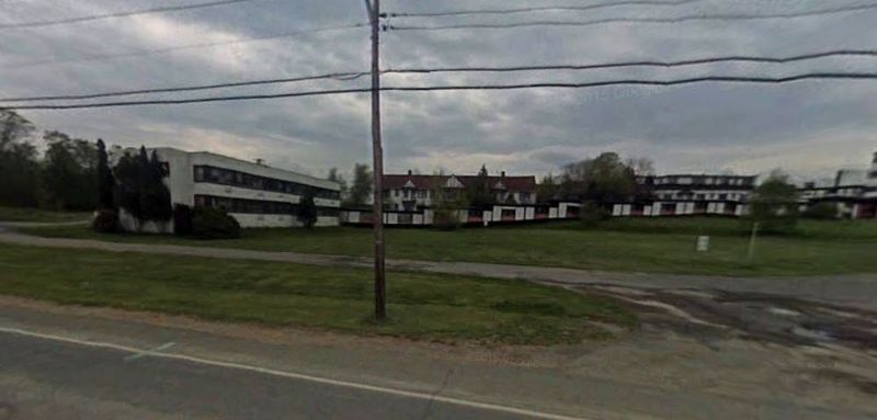
|
|
|
deals
Gender: Female
Total Likes: 34 likes

| | | Re: Using Google Earth in a rural area...
< Reply # 33 on 8/9/2016 5:49 PM >
| Reply with Quote
| | | Posted by TD
I find pretty much all of my locations on Google Earth. Those that I haven't found through google earth I've found while driving to somewhere I found through google earth.
...
For potentially abandoned rural locations, I've found a few things can tell you a lot about a building. Most of them are common sense.
1. Plant growth is huge. In rural areas especially, abandoned buildings aren't going to have anyone on landscaping duty. If you see tall grass, overgrown bushes, anything like that, it's a good sign. Inversely, trimmed bushes and a manicured lawn are a sure sign that the area is occupied.
2. Also look out for a lack of paths towards the building in question. If plants have overgrown the path to the building, or better yet if there is no visible path the building, it's a very good sign the property is abandoned.
3. Use street view when you can. Many rural areas don't have any street view data but it's always worth checking. It's pretty easy to tell whether or not a location is abandoned on street view.
4. Always look for the obvious stuff too. Caved in roofs or holes in the wall means the building legally can not be occupied.
5. Rusted roofs will catch your attention, but they're a very poor indicator of whether or not a building is inhabited. If it were me making the decision and the only indicator of vacancy were a rusted roof, I wouldn't do it.
6. If you're not sure about a location, google it (if it looks big enough to come up on google). Use street view to find building/company names. If that's not an option, and it often isn't, google the address. The address will typically turn up a company/owner name which can then be googled to get more information and boom suddenly you're a historian on the place.
7. Look for cars. If there is a car there that looks like it could move, it's probably got a driver. If there's not a car there, the place could be vacant. I personally use google maps satellite view, not google earth, but google earth, I believe, has a function where you can look up the date and time when the image you are looking at was taken. That might not be true, but if it is that information could be used to your advantage. If the picture was taken early in the morning or late at night, or on a weekend, and there's no car, that's a better indicator of vacancy then if it's at noon on a Tuesday.
...
|
Hey TD... thanks for some great clues to look out for. Some are obvious, especially for veterans, but not necessarily top of mind for me and having a short list to check off is very helpful in evaluating risk of entry and being caught.
|
Everything was beautiful and nothing hurt ... Kurt Vonnegut |
|
|
| This thread is in a public category, and can't be made private. |
|
All content and images copyright © 2002-2024 UER.CA and respective creators. Graphical Design by Crossfire.
To contact webmaster, or click to email with problems or other questions about this site:
UER CONTACT
View Terms of Service |
View Privacy Policy |
Server colocation provided by Beanfield
This page was generated for you in 203 milliseconds. Since June 23, 2002, a total of 739684559 pages have been generated.
|
|